Stephen’s Castle, Verwood. SU090-2.096
Owner: East Dorset District Council.
Management: Phil Baarda, Moors Valley Country Park.. Tel. 01425.470721
Geology: Eocene, Poole Formation and Branksome Sands.
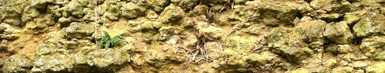
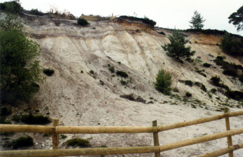
The full section shows a soil profile supporting heathland, underlain by remnant Terrace gravels. In part of the pit (SU 0917 0967) the Poole Formation shows interbedded laminated silty clay and fine- to medium-grained sand. The silty clay beds are lenticular and generally comprise ‘ball clay’ or kaolinite-rich clay.
The clay-rich beds are shown by water seepage illustrating the presence of perched water tables in this Formation. The Poole Formation clays in this area have previously yielded leaf fossils. (Reid C 1902).
The overlying Branksome Sand Formation is seen at [0910 0975] 300m north of Verwood, where a 4 m-high exposure consists of ‘typical’ interbedded sand and clay that dip gently south-east. A brown, highly carbonaceous clay seam occurs toward the top of the cliff. (Barton C.M., Hopson P.M., Newell A.J. and Royse K.R. 2003)
References: Reid C 1902: The geology of the country around Ringwood. Sheet 314. Memoir Geological Survey. P.22
Barton C.M., Hopson P.M., Newell A.J. and Royse K.R. 2003: Geology of the Ringwood District; a brief explanation of the geological map. Sheet 314 Ringwood. [The map has not yet been printed – 1.1.2005.]
In the above volume the front cover is a photograph of Stephens Castle, Verwood taken by P.M. Hopson; GS1248, described as Poole Formation. The Branksome Sand ref. p. 18. This would indicate that both the Poole Formation and the overlying Branksome Sand Formation are present in the old sandpit at the grid references shown.
Access and Parking: park near village hall, walk northward into public open space. No restriction on access.
Education level: Secondary upwards.
Stephens Castle information for website